Hands-Off Start
Autonomous Launch & Transit
Once scheduled, the UAV completes its checks and flies the planned route to each well. No piloting required.
PLAN • FLY • REPORT
Short autonomous flyovers. Standard shots every time. Fast, visual evidence you can act on.
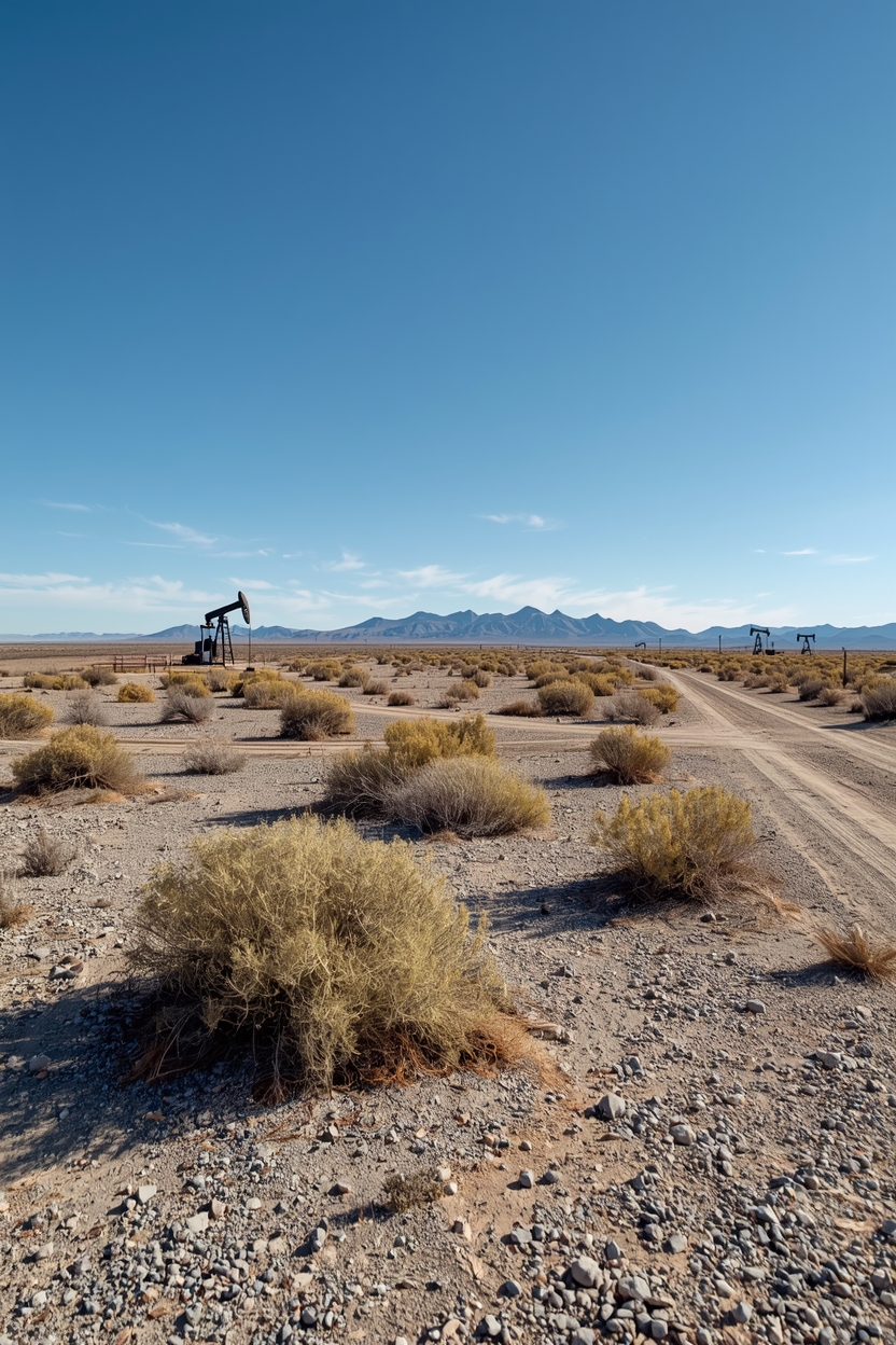
Oil wells don’t fail overnight, but traditional inspections only reveal issues when someone happens to be onsite. Furthermore, many wells need more frequent visual oversight to identify surface-level issues early. Every routine drive-by burns unnecessary fuel, time, and manpower as high priority issues remain unaddressed. Operators lose thousands each month on every well chasing visual checks that automation can assist with. Revos is revolutionizing well monitoring using autonomous fixed-wing unmanned aerial vehicles (UAVs).
EFFICIENCY ELEVATED
Our approach keeps costs low, reduces individual ground inspections, and allows you to catch and prioritize the highest-risk or highest-cost problems before they escalate. Operators gain faster visibility, earlier detection of surface anomalies, and clean, timestamped records that support better field decisions while reducing miles, cost, and even ground visits.

Once scheduled, the UAV completes its checks and flies the planned route to each well. No piloting required.
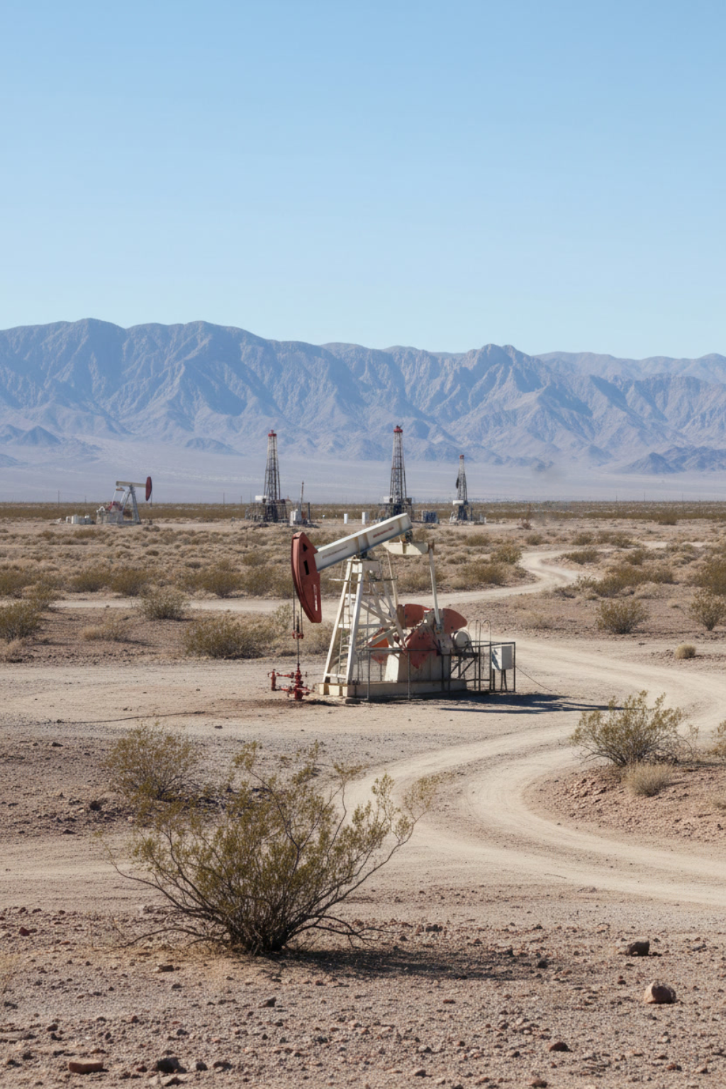
The drone makes a smooth orbit, capturing crisp visuals of the wellhead and surrounding pad so every visit looks the same and is easy to compare.
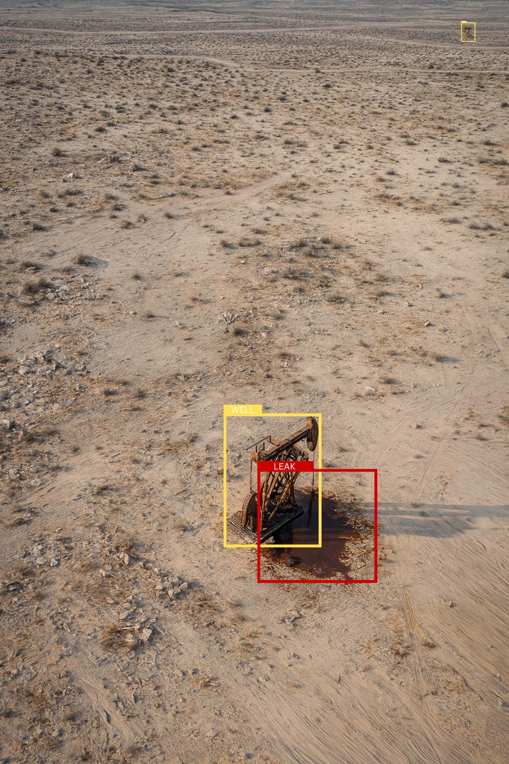
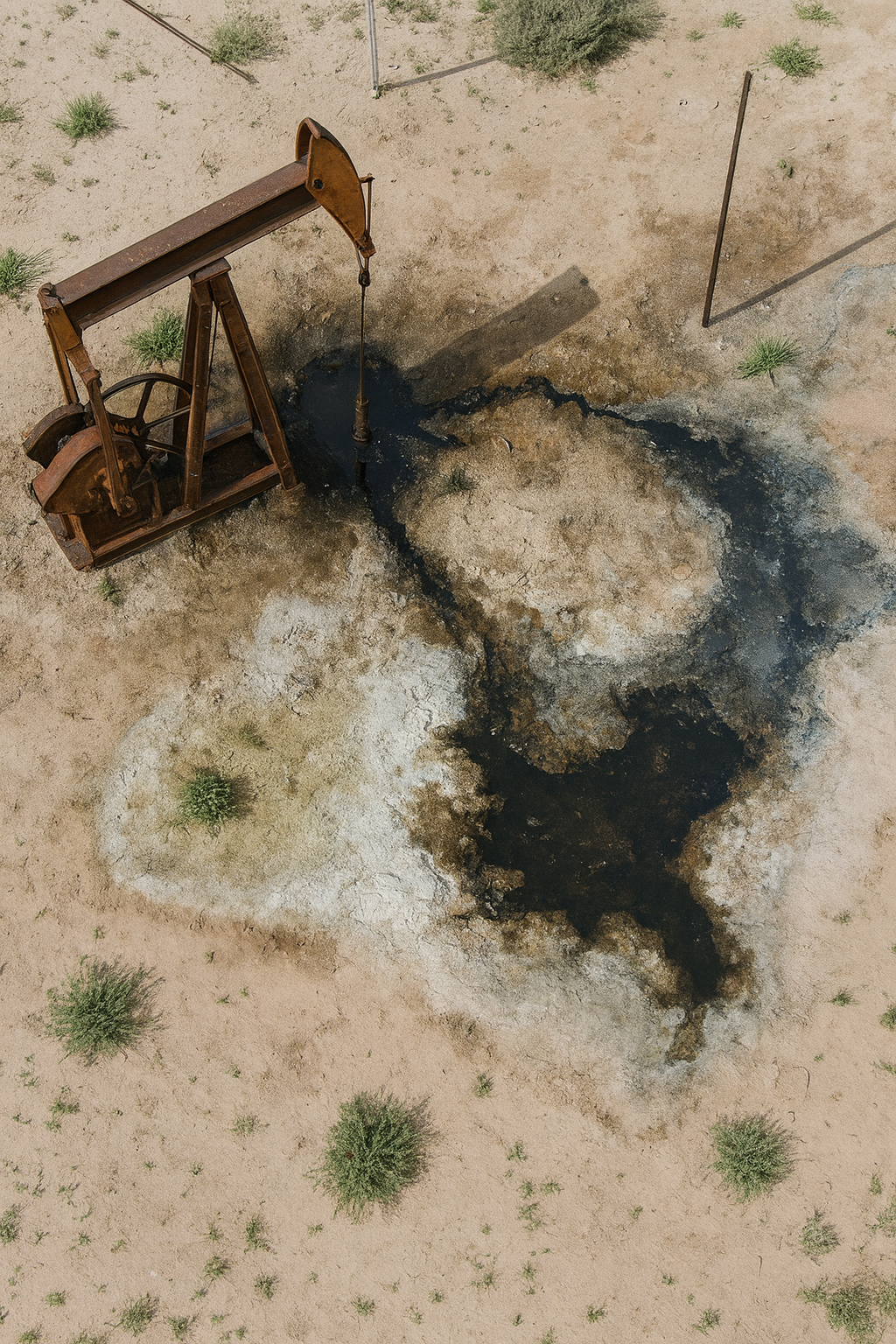
Captured images run through light automated checks that highlight anything unusual, like pooling fluids or an open access point.
If something seems off, you’ll see flagged images with simple callouts. If everything looks normal, you get a clean all-clear message.
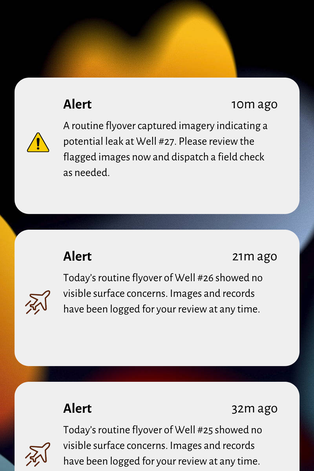
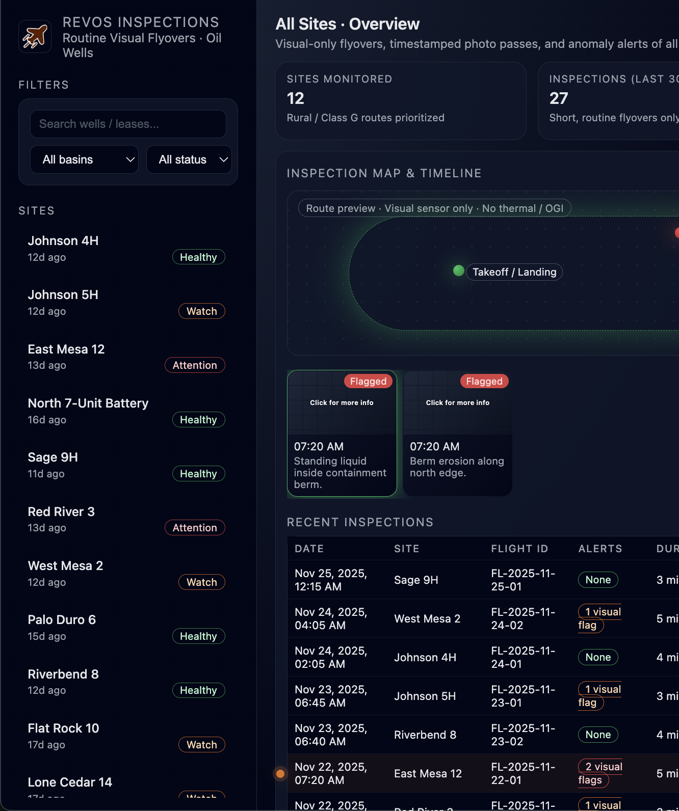
All photos, alerts, and location data are saved in a tidy, timestamped record you can refer to anytime for maintenance or field decisions.
Autonomy That Works
Our UAVs handle flights on their own, launching, navigating the route, and capturing consistent visuals at every well. This level of autonomy keeps workflows simple, speeds up inspections, and helps keep pricing low by reducing labor and unnecessary field miles.